

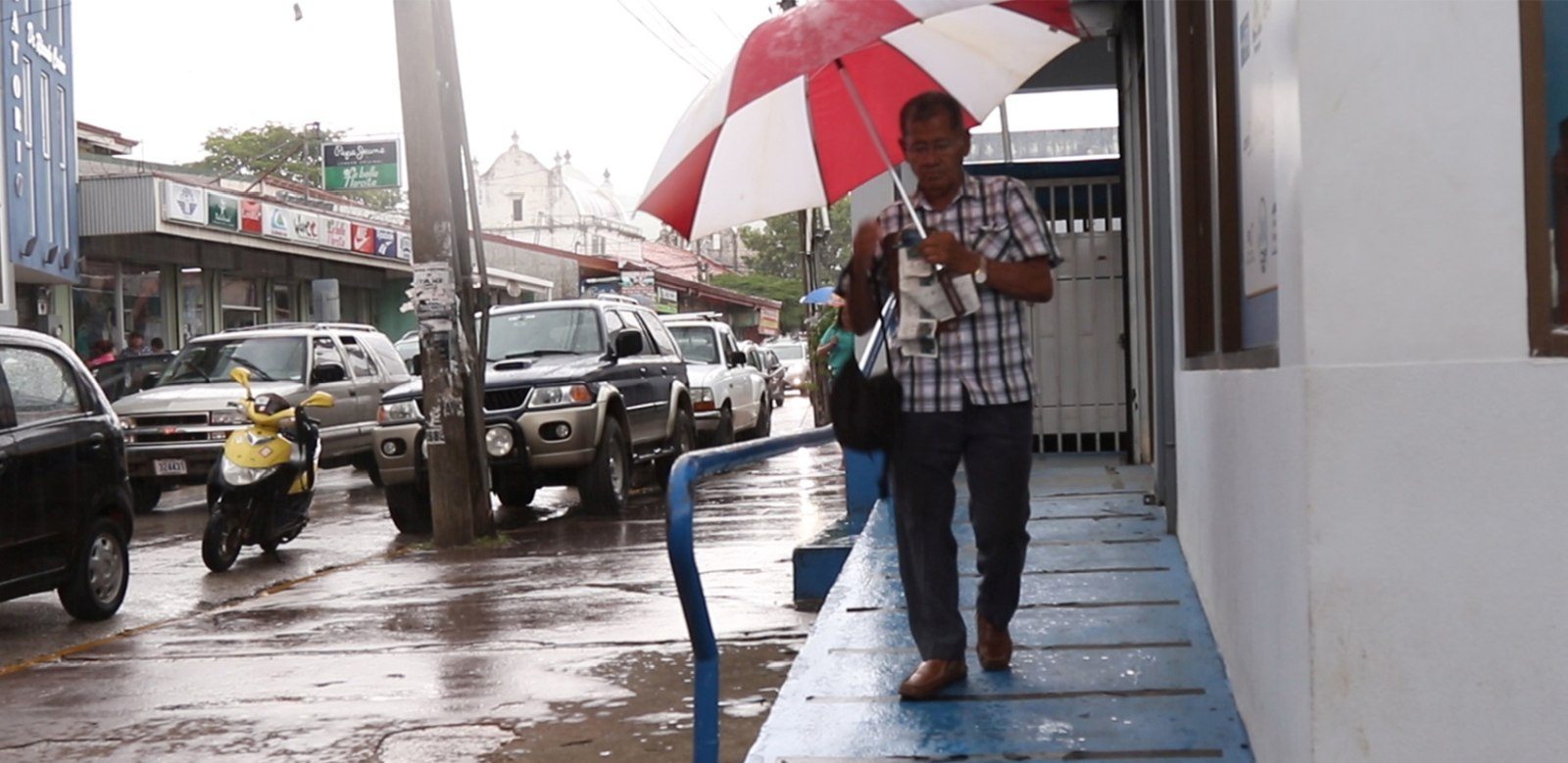
This Friday, November 25 at 6 a.m tropical storm Otto left Guanacaste soil; however, the rains will continue in the mountainous part of the province. According to reports from the National Meteorological Institute (IMN), rainfall during the night in Bagaces and Upala was the equivalent of what normally falls during the entire month of November.
Pablo Valverde of the IMN, reported that Otto is located about 190 kilometers west-southwest of Santa Elena de La Cruz, in Guanacaste’s Pacific waters and is expected to follow its course west away from the country.
Valverde explained that the winds will not exceed 10km / h.
The Pacific coast of Guanacaste will have strong waves; but the climate will remain dry as precipitation will be more directed in the mountainous part as Tilarán.
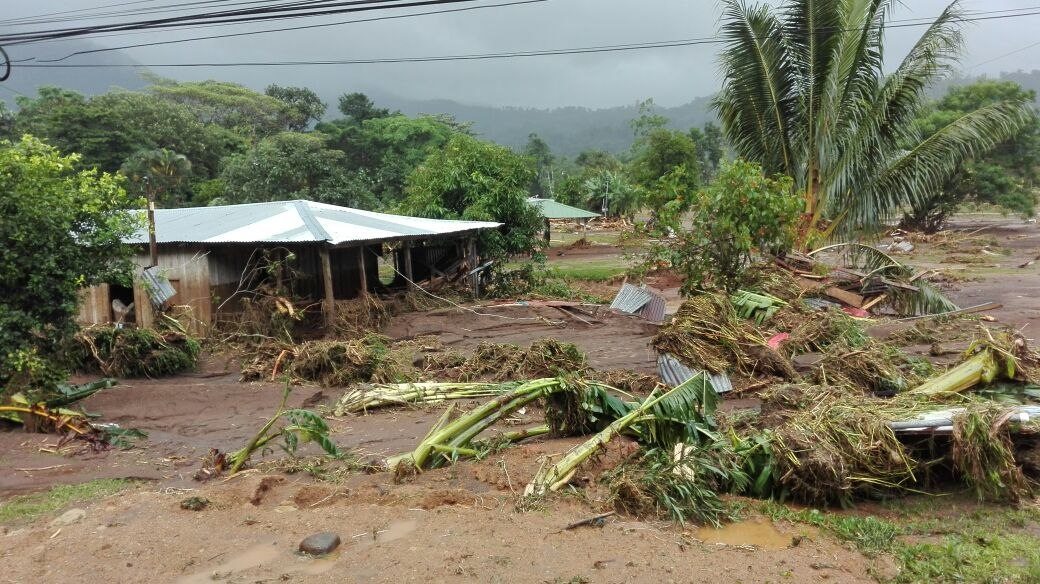
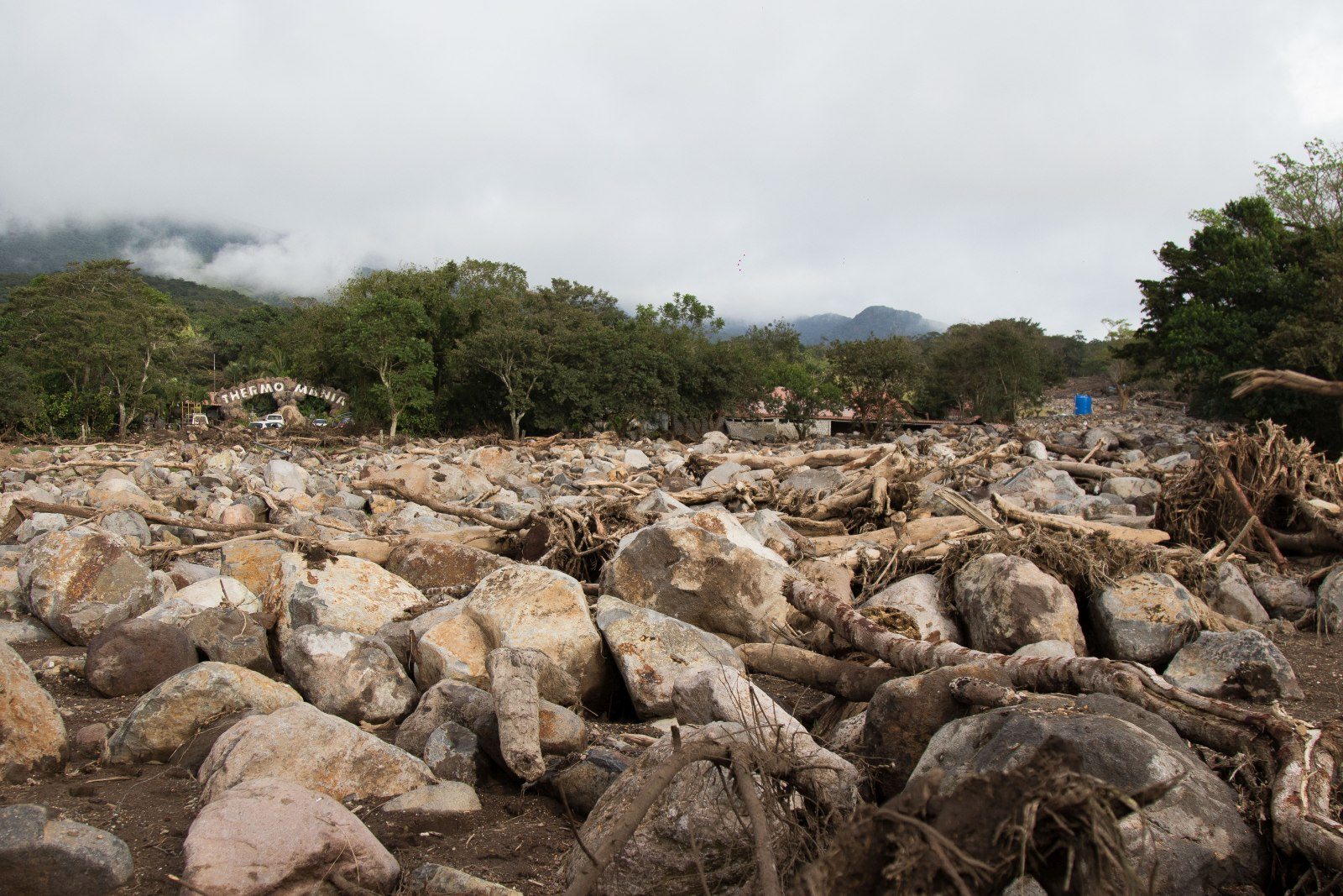
“Today is not a happy day for Costa Rica,” said President Luis Guillermo Solís this morning who confirmed the death of three people killed in the Bagaces district of La Fortuna near the sector to the hot springs.
Closed Routes
The heavy rains caused the closure of the 164 Bagaces-Guayabo national route and the 165 Guayabo-La Fortuna route where there is damage to the Bailey Bridge that communicates to the communities, said Liza Castillo, Deputy Transport Minister.
Another of the national roads closed are route 6 Bijagua-Upala where there is no passage through landslides.
Some of the national routes that are enabled are:
Route 1 Liberia-La Cruz
Route 4 Burma-Santa Celilia
Route 35 Los Chiles-San Carlos
Route 32 Limón-San José.
Ferrys in the Nicoya Peninsula operate normally under monitoring.


Comments