
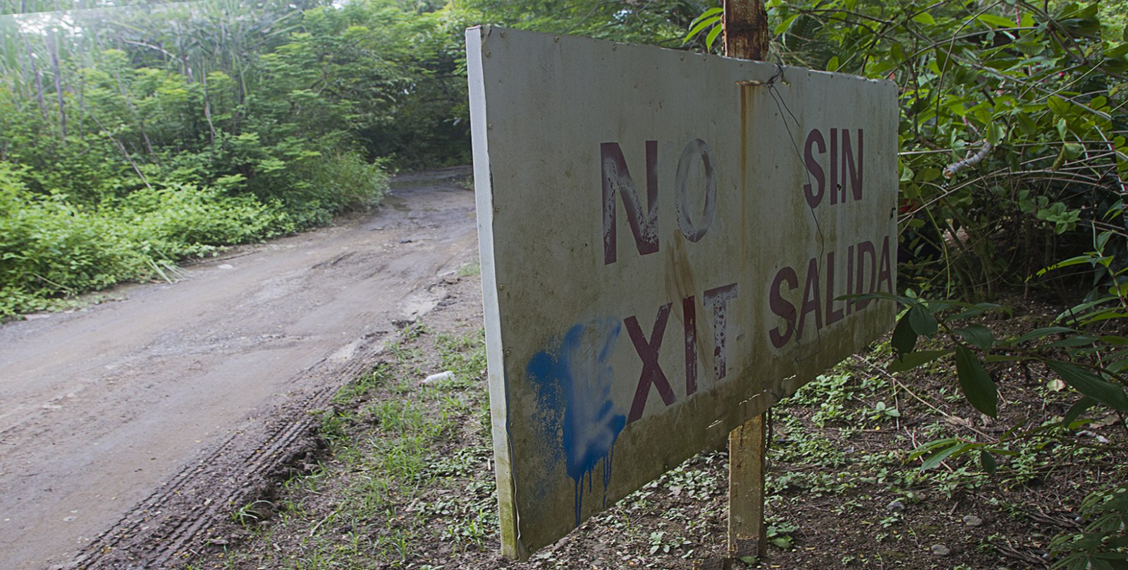

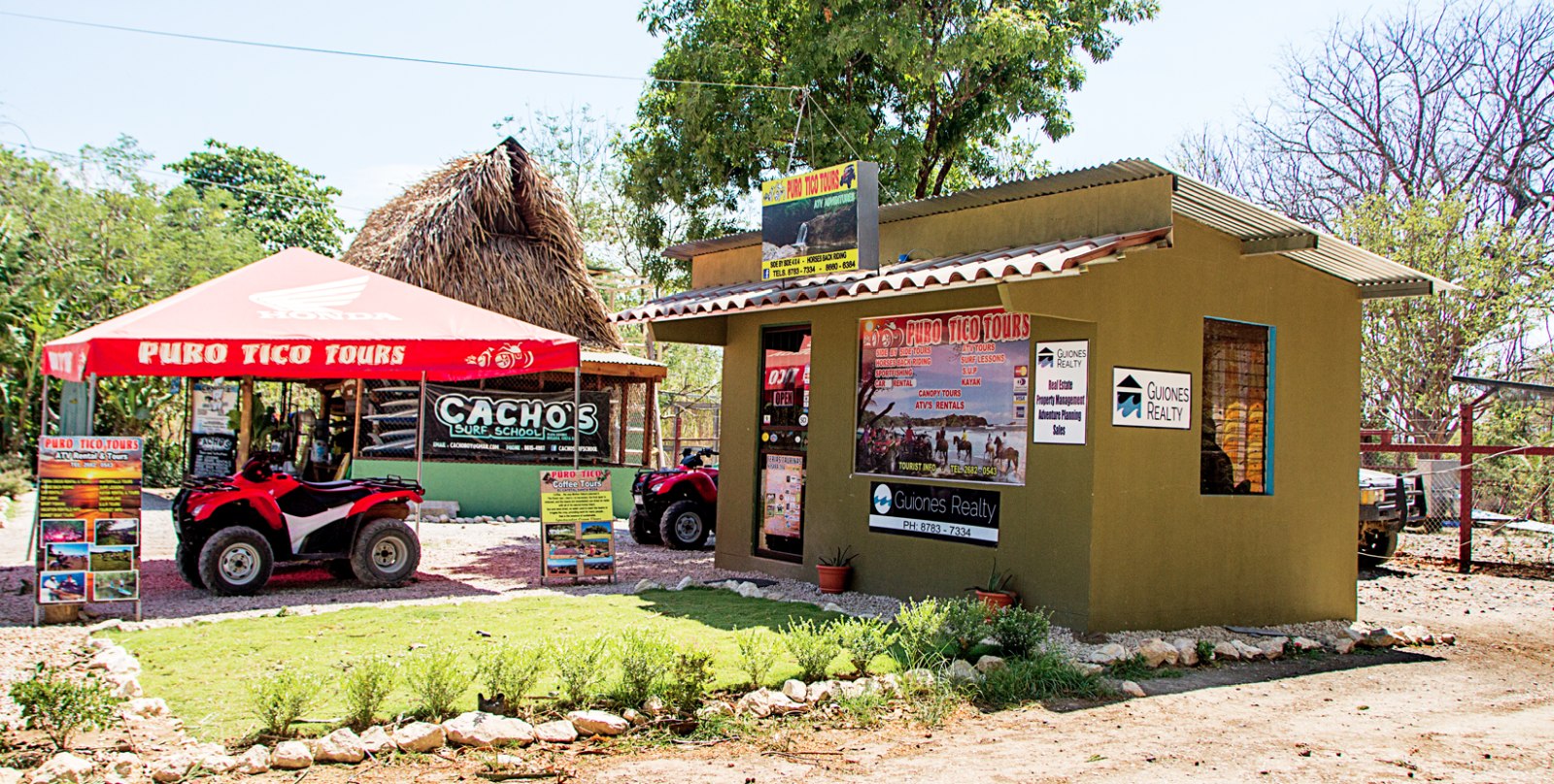
In 2004, a decree from the Minsitry of Environment and Energy (MINAE) banned vehicles from using a 200-meter stretch of road parallel to Guiones Beach, between the cemetery beach entrance next to Cacho’s surf rental and a residential area at the end of the road from Giardano Tropical where Nosara Travel´s office is located. On September 25, the road was reopened after a new resolution from MINAE reversed the previous decree.
While some are happy about the reopening because it provides a more direct route connecting the two areas, more than 20 neighbors, area businesses and organizations have signed a petition to close the road again, concerned about protecting the refuge and maintaining safety and peace in the area. The key issue legally is if the entrance to the road is within the limits of the Ostional Wildlife Refuge or not.
“Regarding this subject, at the request of the Municipality of Nicoya, the regional direction (in Ostional) issued an administrative resolution indicating that the previous closure be lifted because the closure is located outside of the refuge and it is left to the municipality’s criteria as their jurisdiction to keep it or remove it,” Carlos Hernandez Rosales, administrator of the Ostional Refuge for MINAE, explained to The Voice.
The resolution from MINAE to reverse the earlier decree that closed the road cited a report by Hernandez dated November 28, 2012, in which Hernandez attested that the point where the road was closed is not within the refuge but rather on the borderline of the protected area, and in addition stated that the closure made in 2004 did not prevent vehicles from entering or exiting the section of the road that is within the refuge, therefore lacking effectiveness.
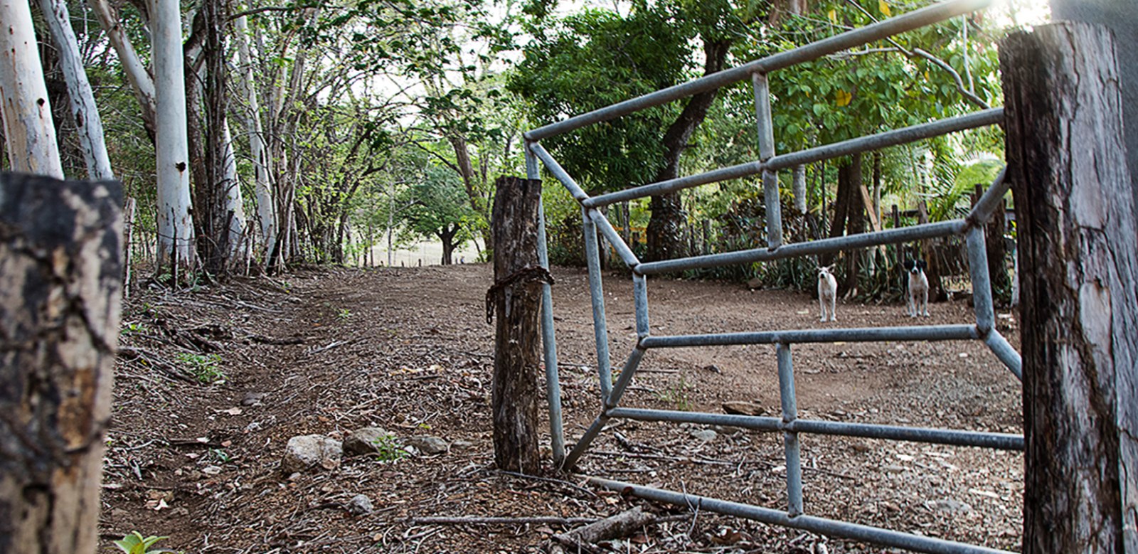
The closure, located on the residential side of the road, was a gate designed to allow pedestrians and bicycles to pass but not motorcycles or cars. However, vehicles could enter the road from the south side near Cacho’s, thus allowing vehicular access to the properties and houses that are located on the road but not allowing through traffic.
Marcos Avila, district syndic and president of the Nosara Integral Development Association (ADIN), pointed out that with the road open, people no longer have to drive out toward Café Paris and around to get to the area where Gilded Iguana is located. He explained that the investigation to reopen the road was initiated by his father, Cuyo Avila, four or five years ago when he was the syndic for Nosara, and that the process to do so is long and has to be done in conjunction with the mayor’s office and the municipal technical unit.
He also mentioned to The Voice that ADIN plans to take steps to reopen other roads as well at the request of community members. “The law states that every public road must be open,” he affirmed, so the first step that they are currently taking is to verify with the land registry office whether the roads in question are actually public roads. Some of the roads being examined include a road from Huacas to Esperanza that comes out behind Chaman’s (former Banana Bar) and another road by the former Hotel Villaggio that also goes to the refuge, providing people easier access to Playa Guiones from Garza.
Julio Lopez, municipal engineer, confirmed that the mayor’s office made the decision to reopen the road after MINAE annulled the 2004 decree. He also indicated that he is aware of efforts by ADIN to reopen other points but said the points haven’t been defined as no formal request has been made to the mayor’s office yet.
In or Out or the Refuge?
Don Haskin, who lives next to the entrance to the road at the point where it was closed, is leading efforts to petition for the road to be closed again.
As a land registry map of the refuge from the Tempisque Area of Conservation (ACT) began to circulate with a dotted boundary line superimposed on an aerial satellite image of the area, questions arose. On the map, the boundary line curves, placing the north section of the road in question outside of the refuge. However, Haskin noted, the coastline does not appear to have such a curve, so he questions what data the line is based on. In 2012, Haskin hired Huber Vargas Ramirez, an engineer and topographer, to mark off and map the 200-meter boundary of the maritime zone. The results from Vargas’ measurements show the entire road within the refuge.
Edwin Hernandez Ramirez, who assisted the topographer, explained that the results are well-referenced since they measured from all of the “mojones” (official posts marking the maritime zone) located on the beach using GPS.
Engineer Miguel Nema Orozco is collaborating in the effort to re-close the road, trying to negotiate with the municipality and MINAE. At this point, on October 24, Mauricio Mendez Venegas, subdirector for ACT, emitted a request for a study to identify possible impacts within the refuge as a result of the opening of this road.
If negotiations don’t succeed, Nema said they will file a formal denunciation against both entities.
“We believe that they can’t for any reason make the decision to open the road based on cartographic pages, when a plan supplied by us clearly exists regarding the existing mojones. The road, according to the plan supplied, is inside the refuge. We also want to demonstrate the negative impact the refuge would have with the opening of this road,” he explained.
Convenience Versus Conservation
In October, the road was dotted with potholes filled with water and mud, dissuading many from beginning to use it, although Karen Haskin said she had already seen motorcycles and quads starting to race down the road and even saw a backhoe go down it. The Haskins fear that as the road dries up in November, increased traffic will also increase dust and danger within the refuge. And they aren’t the only ones.
Federico Gurdian, manager for Hotel Harmony, is also concerned since their guests walk to the beach from the hotel along a path behind the hotel that crosses the road. Visibility from the path is limited, so Gurdian worries that the people might get hit by vehicles driving fast down the road.
He is also concerned that people going to the beach will start parking their vehicles along the road, making them targets for thieves, as well as increasing noise, for example when car alarms go off, and affecting the fauna in the refuge. As a preventive measure, the hotel donated trees to Costas Verdes to plant along the side of the road, making it more difficult to park cars there. The trees are species like jacote that are typically planted as fence posts in Costa Rica.
For her part, Wantana Panpaisal, who owns a property on the road, said she is neutral on the issue. She likes it closed because it keeps the refuge area tranquil, but she also likes it open for the convenience of not having to drive all the way down the road through the potholes to get in or out. “If it was closed and the road there was fixed, I would be happy,” she concluded.

Comments