
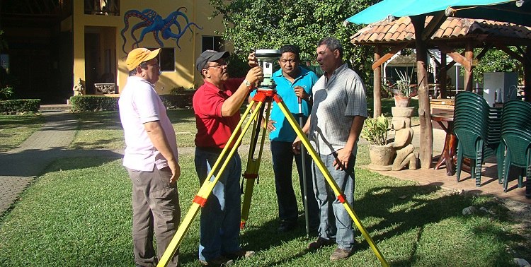

New GPS and topography equipment purchased by the Municipality of Nicoya should facilitate better performance by the engineering, land registry and maritime land zone departments.
In total, the new equipment cost around 19 million colones ($38,000), including the GPS unit, a complete station (conventional topography), radios, a camera and metric tapes, according to Alexander Hernandez Santana, topographical engineer in the municipal land registry department.
“Before we only had a metric tape,” he said, explaining that topographical jobs had to be contracted by the municipality, which created delays and additional expenses. The equipment was bought from Moviles de Costa Rica, and a technician from the company conducted a four-day training in Samara in January, attended by members of the engineering, roadways and maritime land zone departments.
Juan Carlos Oviedo Quesada, head of the maritime zone department, attended the training and said he hopes the new equipment will allow them to give more precise information in the maritime land zone, for example being able to replace missing maritime zone markers (called mojones).
The municipality is already putting the equipment to work for a road project in the Los Angeles neighborhood of Nicoya, where they measured the width of the roadway in preparation for pavement, according to Hernandez.


Comments