

*This guide is constantly being updated so that you have the latest information.
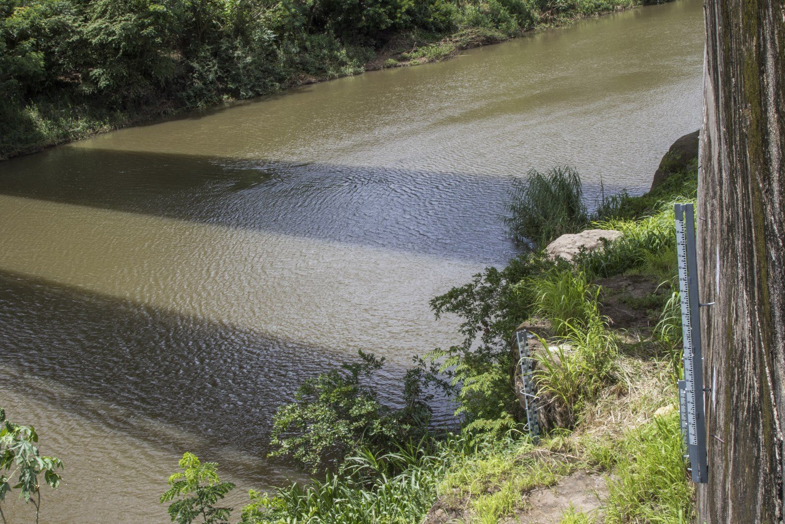
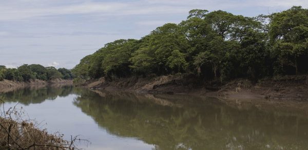
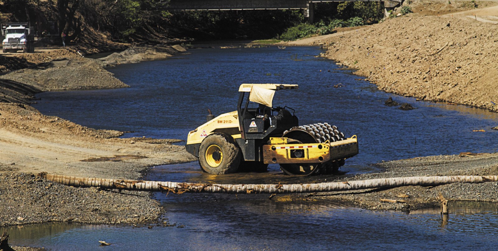
During the next three months, you’ll have to be patient in order to travel between Guanacaste and San José. Starting April 1, and until July 24, according to the promise made by the Ministry of Public Works and Transportation (MOPT), the La Amistad bridge over the Tempisque River will remain closed for repairs.
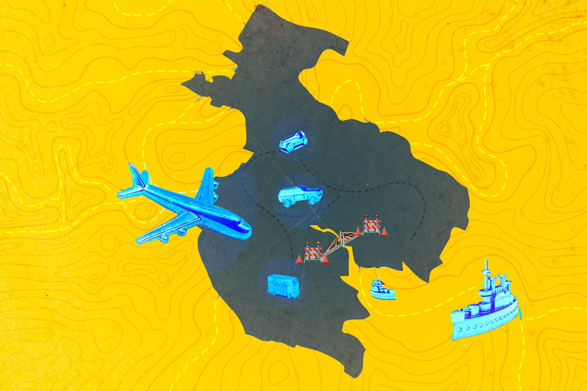
On March 20, the Ministry of Public Works and Transportation published a series of measures and alternative routes for traveling between the provinces. Since there were several questions still unanswered, at The Voice, we made the necessary inquiries and with this information, we prepared a guide with everything you need to know to decide which of the six alternatives best suits you when traveling to and from Guanacaste.
In this guide, you can find the details to cross the Tempisque by boat, travel by car along the routes indicated by the Ministry of Public Works and Transportation (MOPT), go across the gravel road through the Hacienda El Viejo, take the ferry, journey by bus or reach your destination by plane.

The MOPT promised a free boat service to cross the Tempisque River starting on Wednesday, April 3.
Although the bridge was closed on April 1st, the director of the Maritime Port Division, Verny Jiménez, commented that the boats are not ready yet. The official estimated that the service could be enabled until next Monday, April 8.
“The boats have yet to be taken (to the river). They are not ours, they belong to the National Learning Institute (INA, Spanish acronym). The INA has to move them,” he mentioned.
Who can use the boats?
Anybody can use this service. The only thing you have to do is get to the docking points (see next answer) and wait for the boat to be available.
What is the boat’s route?
The boat route is planned to start next to the La Amistad bridge (on the Nicoya side) and go to a pier that MOPT set up on the Bebedero River. According to Jiménez, another alternative is for the boat to leave Puerto Níspero and make its way to Puerto Madero.
How many people can travel per trip?
Each boat has a capacity of twenty people per trip. Each person will be seated and wearing a life jacket.
If I go by car, is there an area set up to leave it before boarding the boat?
No. If you arrive by car, you’ll have to find a place to park it on your own. If you leave the car there, it’s at your own risk, according to the director of the Maritime Port Division, Verny Jiménez.
What’s the schedule for each trip?
There is no specific time for each trip, but the boats will be available between 5 a.m. and 5 p.m. The boats will go from one point to another on the route and the trips will be made when there are people needing the service.
How long does each trip last?
Each trip takes approximately five minutes.
Why set up a boat and not a ferry to cross the river?
Jiménez commented that there are two reasons that prevent a ferry from being set up on the Tempisque River: There are no ferry boats available and, even if there were, the river’s water has a lot of sediment that prevents this type of boat from being able to navigate the channel.

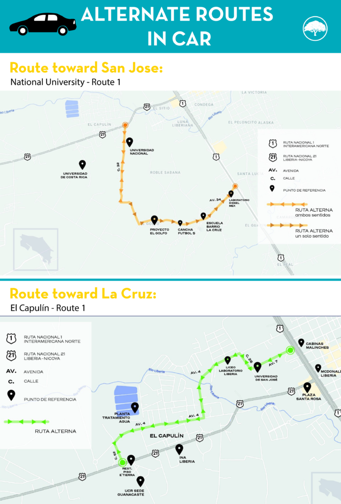
Among the alternate routes, MOPT announced two municipal roads to decongest the intersection at the entrance to Liberia. One of them is temporarily closed and the other can’t come into play until a legal problem is resolved.
Peninsula – La Cruz
If you come from the peninsula heading in the direction of La Cruz or vice versa, you can use the road that connects the El Capulín neighborhood directly with the Inter-American Route. This route is paved but has a lot of potholes.
Take note, the road is currently closed while CONAVI works on installing a modular bridge over the Liberia River. Dorian Ulate, engineer of the Technical Unit of Road Management of the Municipality of Liberia, said that there’s no a defined date for its installation. The infrastructure will allow passage through the area in both directions (La Cruz-Liberia) since there was a single-lane bridge up until now.
Peninsula – San José
If you come from the peninsula heading in the direction of San José, you should know that the Municipality of Liberia will prepare a cantonal road through the National University sector that takes you directly to the Inter American Highway crossing the La Cruz neighborhood.
But pay attention! This route proposed by MOPT isn’t ready. According to Ulate, from the Municipality of Liberia, they’re just now working on rebuilding the road and going this way isn’t yet allowed. Why? The route crosses a property that is owned by the administrative board of the Guanacaste Institute and the Municipality has to sign agreements to be able to begin the improvement work. The work consists of making a gravel road, since what is there currently is a path that crosses a pasture with gates and no signage.
“Right now, passage isn’t allowed. Taking a car there is prohibited because it’s a plot of land, so we’re passing through private property, and secondly, it’s damaging the car,” Ulate affirmed.

According to Brian Campbell, administrator of Hacienda El Viejo, people should only go this route if they have no other choice. This road is used every day to transport sugar cane and is not intended for regular vehicle traffic. It’s not a safe option and there are many parts without cell phone signal. In addition, the road is made purely of dirt and gravel.
Where does this route go and how many kilometers would I have to drive?
MOPT recommended the route from Filadelfia to Bagaces. This route is approximately 60 kilometers (37 miles). However, Campbell recommends traveling by the other route that connects Filadelfia with Pijije, which is about 50 kilometers (31 miles) long.
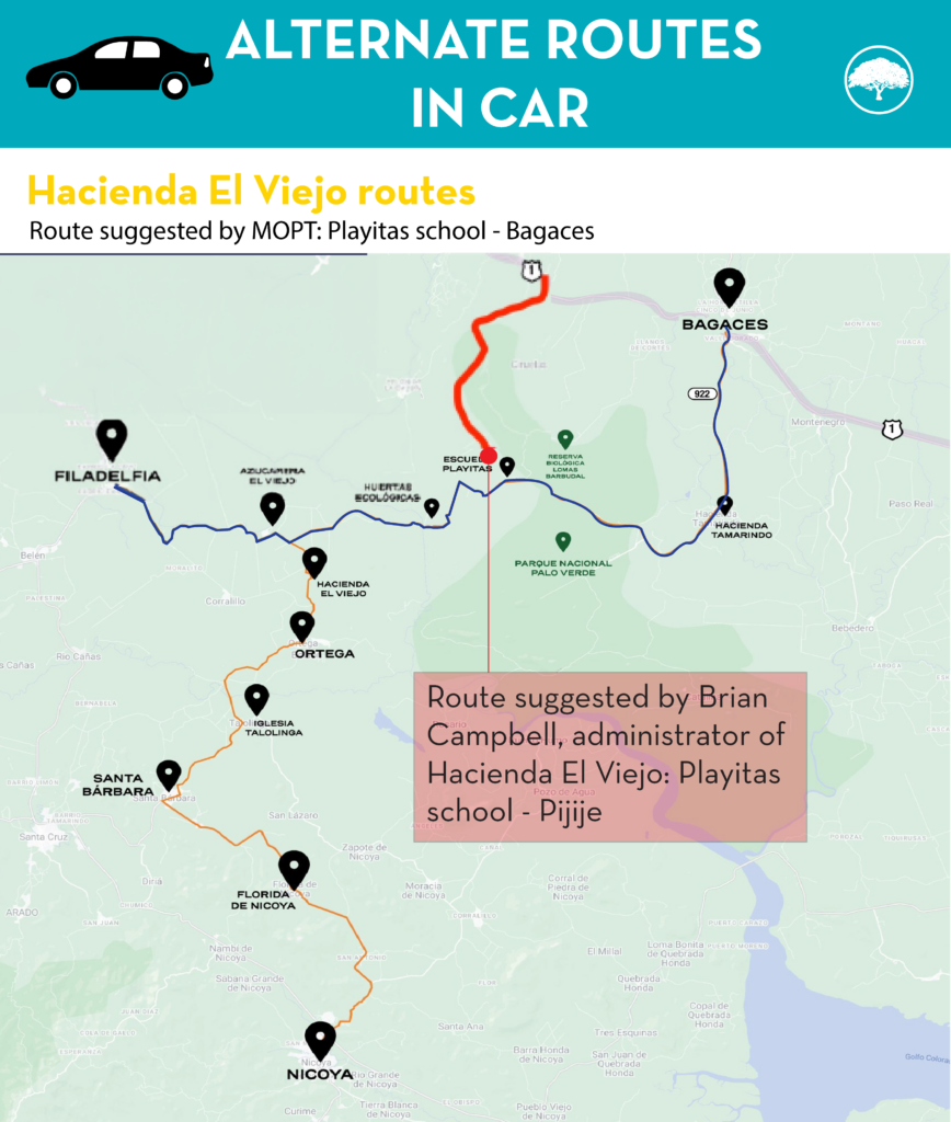
Is it safe to travel through Hacienda El Viejo?
The administrator of the hacienda himself does not recommend using these routes. The route has no lighting, little (or no) cell phone signal, no type of signage and there are routes where the road is one lane. If you lean towards this alternative, you should be careful with the tractors and agricultural equipment that constantly take over the road.
Is it a route suitable for all types of cars?
Mainly for high vehicles. The poor condition of the road can be complicated for automobiles. It isn’t recommended for trucks either because there are parts that are very narrow.
Are there hours of use?
There are no hours of use. The routes are open 24 hours a day.
Does traveling through the hacienda have any cost?
Using these routes has no cost. It’s a private road that can only be used in the dry season. At this time, given the crisis due to the closure of the bridge over the Tempisque, the possibility was offered that other people who don’t work for the company could use it.
How long is the estimated travel time on this route?
The estimated time is an hour and a half. You have to travel slowly, about 30 or 40 kilometers per hour (18 to 25 miles per hour) all along the route. However, there may be times where you will have to wait for agricultural machinery to finish its work before being able to continue the trip.

Where are the docks?
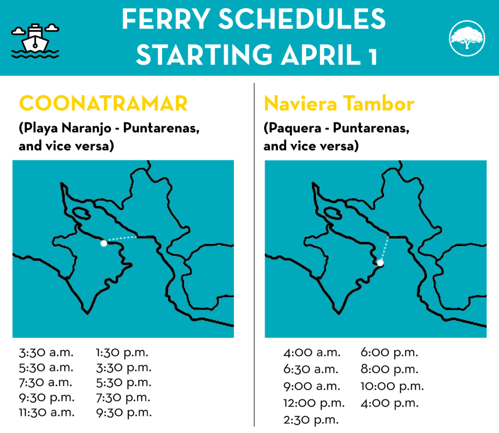
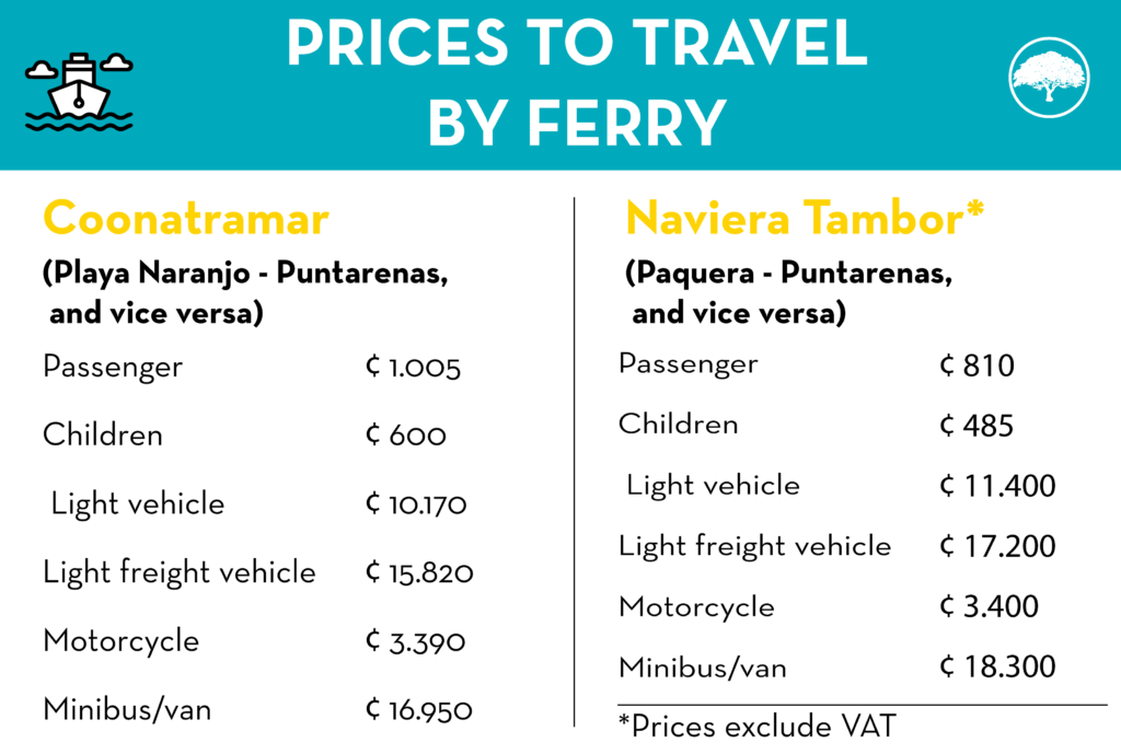
Naranjo – Puntarenas Ferry
In the direction of Playa Naranjo – Puntarenas: Google maps
In the direction of Puntarenas – Playa Naranjo: Google maps
Paquera – Puntarenas Ferry
In the direction of Paquera – Puntarenas: Google maps
In the direction of Puntarenas – Paquera: Google maps
What are the ferry schedules after the La Amistad bridge closure?
How long does the trip last?
Paquera – Puntarenas Ferry
The trip lasts approximately one hour.
Paquera – Puntarenas Ferry
The trip lasts approximately 1 hour and 15 minutes.
Where do I buy tickets?
Naranjo Beach – Puntarenas Ferry
You can purchase tickets at the site www.coonatramar.com. To buy them, you have to open an account in specialticket (within the Coonatramar site) at this link.
Paquera – Puntarenas Ferry
You can purchase tickets at the site https://www.quickpaycr.com/.
Take note! It’s important that you keep in mind that both companies will only have 50% of their tickets available on their website. The rest of the ferry capacity can only be bought in person at each company’s ticket window. Both purchase sites are in front of the dock. This means that if you don’t find space available on the websites, you can go to the respective ticket windows. Sales at the windows begin one hour before departure.
How much does it cost to travel by ferry?

Which routes will travel by ferry and which will travel through Liberia?
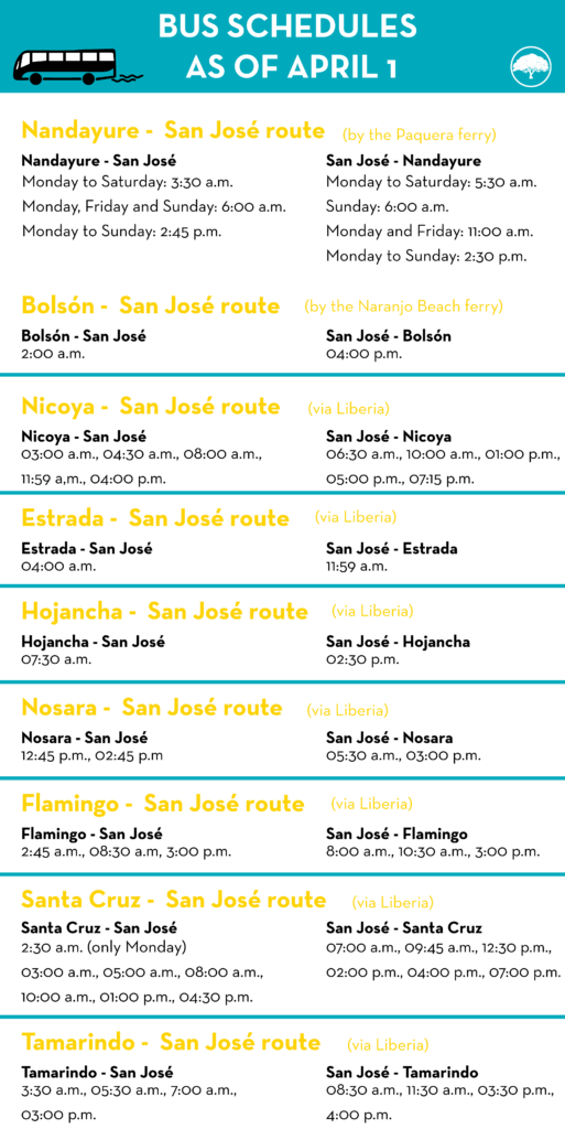
- Route 1501 (San José – Quebrada Honda – Corralillo – San Antonio – Santa Bárbara – Ortega – Bolsón and vice versa) will be used by the company Alfaro Limitada and will travel by the Playa Naranjo ferry.
- Route 512 (San José – Nandayure – Jicaral and vice versa) will be used by Ryozumo and will travel by the Paquera ferry.
- Routes 1507 (San José – Nicoya – Hojancha – Samara – Playa Carrillo – Estrada – Nosara and vice versa via La Amistad bridge) will be used by Transportes Inteligentes de Guanacaste (TIG) and will travel through Liberia.
- Route 1502 (San José – Santa Cruz via La Amistad Bridge; San José – Belén – Tamarindo via La Amistad Bridge; San José – Tamarindo via the Inter-American Highway; San José – Playa Flamingo via the Inter-American Highway; San José – Playa Flamingo via La Amistad Bridge) will be used by TIG and will travel through Liberia.
What are the bus schedules?
Are the rates the same?
None of the bus companies requested an increase in fares, according to the Public Services Regulatory Authority (Spanish acronym: ARESEP).
Furthermore, the ferries won’t charge either the buses or the passengers traveling on those buses, confirmed the maritime companies.

During the La Amistad bridge closure, the airline Sansa has increased the number of flights between Guanacaste and San José. The trips connect Juan Santamaría Airport with Tamarindo, Nosara and Liberia.
How many flights will connect San José and Guanacaste?
Mora estimates that the flights between San José and Tamarindo will go from three daily to approximately six. In addition, between San José and Nosara, they will increase from four trips daily to approximately seven, and between San José and Liberia, they will go from 11 flights to 13.
According to Sansa’s sales manager, Pablo Mora, it isn’t possible to define a fixed number of flights per day. The commercial manager recommends looking at the airline’s website www.flysansa.com. Flight availability information, schedules and prices are available for any date from April to October of 2024.
Although MOPT commented on the availability of flights between the capital and Nicoya, Mora confirmed that they did not set up flights to the canton.
How much will the trips cost?
A one-way trip from San José to Tamarindo, Nosara or Liberia can cost you between approximately ₡46,000 ($93) and ₡75,000 ($150). The return flight has the same rate. When you select the travel date, the website will indicate the exact cost of the flight. The price may vary depending on the luggage you are taking with you.
How do I get tickets?
Tickets can only be purchased through the site https://www.flysansa.com/.
How many people can travel per flight?
Each small plane has a maximum capacity of 12 passengers. The luggage weight will depend on the ticket you purchase.
Will they only increase the number of flights from San José to Guanacaste?
No. The reinforcements are both ways: from Guanacaste to San José, and from San José to Guanacaste.
How long does each flight last?
Although flying is the most expensive option for getting around, it’s also the fastest option. Flights between San José and Guanacaste last approximately 45 minutes.

Comments