

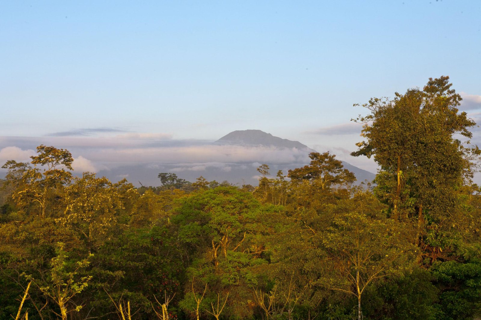
They are the giants of Guanacaste that, for millions of years, have seen the province’s transformation. Each volcano has a story to tell. Visiting them is a must due to their scenic beauty and their natural value, as well as because of the tectonic sediments that lie within them. When they wake up, they capture the attention of locals and foreigners alike.
OROSI VOLCANO:
HEIGHT: 4724 feet above sea level.
ACTIVE: No
LOCATION: 30 kilometers (19 miles) northeast of the city of La Cruz, near the Nicaraguan border.
HOW TO GET THERE: From Liberia, head 44 kilometers (27 miles) along Route 1 (Pan-American Highway) toward La Cruz, then turn right just before reaching the Cuajiniquil checkpoint. From there, continue about 16 kilometers (10 miles), passing Hacienda Orosi, until you reach the volcano.
LAST ERUPTION: 10,000 years ago
FLORA AND FAUNA: The volcano is located in the Guanacaste National Park, surrounded by an intermediary elevation wet-dry transition forest ecosystem and rain forest, where you can see a large number of animals.
TOURIST ATTRACTIONS: In the Maritza Biological Station, the headwaters of the Tempisque river, and the Sapoa river. The Pedregal Site where there are hundreds of petroglyphs (figures carved on rock) with more than 1,500 years old.
AGE OF THE VOLCANO: ONE MILLION YEARS
INTERESTING FACTS: According to some, the origin of the name Orosi is linked with a legend. It is said that at one time, a priest tried to climb to the top accompanied by some indigenous people. Noting that as he advanced, the earth trembled and the volcano thundered, the religious leader exclaimed, “This volcano must have silver mines.” From the hill, a strong and mysterious voice replied, “Plata no, oro sí,” which means, “Silver no, gold yes.” Therefore, the name should be pronounced with the accent on the i, as opposed to the Orosi that is in Cartago, where the accent is on the second
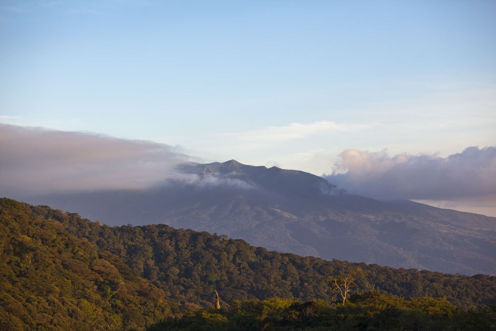
CACAO VOLCANO:
HEIGHT: 5443 feet above sea level
ACTIVE: No
LOCATION: Located 5.5 kilometers (3.4 miles) southeast of Orosi Volcano.
HOW TO GET THERE: From Liberia, go 25 kilometers (15.5 miles) along Route 1 toward La Cruz, then turn right at the entrance toward Quebrada Grande. Continue 37 kilometers (23 miles) along Route 917, passing Dos Rios. Going up the mountain range is not easy.
LAST ERUPTION: HApproximately 600,000 years ago.
FLORA AND FAUNA: Jungle vegetation in the upper area.
TOURIST ATTRACTIONS: Cacao Biological Station. The Pedregal hill.
AGE OF THE VOLCANO: Approximately 1,000,000 years.
INTERESTING FACTS: To the southeast of Cacao, there is a minor volcanic cone with a chipped crater (with an opening) in its western sector, which is known as Pedregal hill.
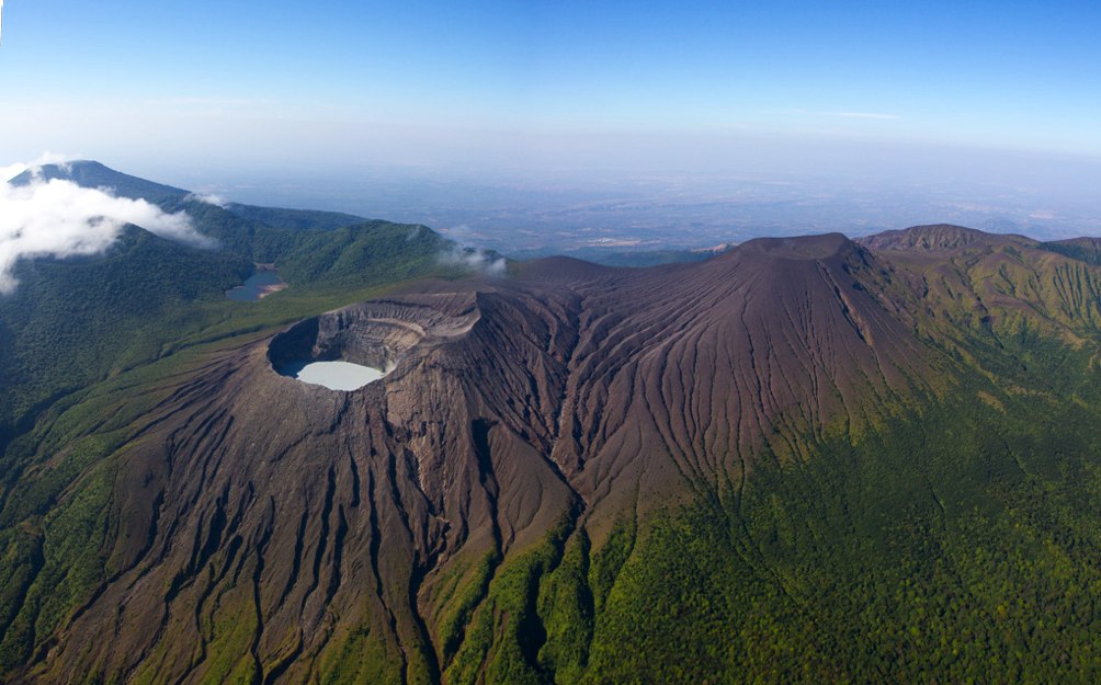
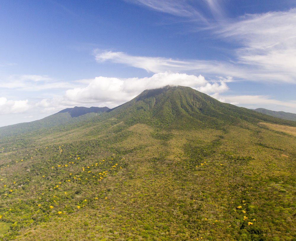
RINCON DE LA VIEJA VOLCANO:
HEIGHT: 6217 feet above sea level
ACTIVE: Yes.
LOCATION: 25 kilometers (15.5 miles) northeast of the city of Liberia, between the provinces of Alajuela and Guanacaste.
HOW TO GET THERE: From Liberia, you should follow the Pan-American Highway (Route 1), heading towards Nicaragua (5km/ 3 miles) to the community of Guadalupe. Then you turn off toward the east toward the community of Curubande, continuing for 20 kilometers (12.4 miles) on a gravel road to the entrance to the Las Pailas sector.
LAST ERUPTION: March 10, 2016.
FLORA AND FAUNA: Tropical wet forest and wet forest. The fauna is varied. Species found there include deer, coati, mountain goats, collared peccary, lowland paca, raccoons, armadillos, sloths, tapirs, puma, agouti and monkeys, among others. Thirty-two rivers have their sources there, including the Colorado, Blanco and Ahogados rivers. It also protects the largest population of purple orchids that exists in the wild.
TOURIST ATTRACTIONS: The Rincon de la Vieja National Park. There are two visitors areas: Las Pailas and Santa Maria. You can walk along trails to observe volcanic manifestations you can visit waterfalls, wooded areas and open areas.
AGE OF THE VOLCANO: 1,000,000 years (approximately)
INTERESTING FACTS: The crater lake is one of the most acidic in the world because it has a significant amount of sulfur and chlorine. According to research, the name of the volcano is possibly due to a very old woman who once lived in the area whose home was known as “el rincon de la mujer vieja” (the corner of the old woman).
MIRAVALLES VOLCANO:
ALTURA: 6654 feet above sea level
ACTIVE: Yes
LOCATION: 30 kilometers (19 miles) north of downtown Bagaces.
HOW TO GET THERE: From downtown Bagaces, head along route 164 and then 165 toward the community of La Fortuna for about 30 kilometers (about 19 miles). The road is paved up to the foot of the volcano.
LAST ERUPTION: About 8000 years ago, approximately.
FLORA AND FAUNA: Tropical plants, deer, collared peccaries, armadillos, raccoons, sloths, tapirs, pumas, jaguars, monkeys and birds.
TOURIST ATTRACTIONS: The Miravalles Geothermal Project.
AGE OF THE VOLCANO: Approximately 1,000,000 years
INTERESTING FACTS: The original name of the volcano was Cuipilapa, a Nahuatl word meaning river of various colors, and it was a term that the indigenous people used for the mountain ranges. The name was later changed to Miravalles due to the name of a hacienda owned by Crisanto Medina, a resident of the area.
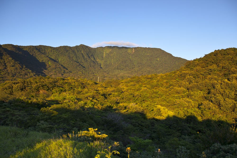
TENORIO VOLCANO:
HEIGHT: 6286 feet above sea level.
ACTIVE: No.
LOCATION: 15 kilometers (9 miles) southeast of Miravalles Volcano.
HOW TO GET THERE: From Cañas, travel 6 kilometers (3.7 miles) on Route 1 towards Bagaces, then turn right at the intersection towards Upala on Route 6 for 21 kilometers (13 miles) and turn right again on Route 927 for 7 kilometers (4.3 miles).
LAST ERUPTION: 10,000 years ago
FLORA AND FAUNA: Evergreen forest composed of premontane rainforest and cloud forest. Predominantly palms, heliconias, ferns, orchids and bromeliads. There are an enormous number of species of fungi, headwaters of rivers, varied wildlife, lowland paca, tapir and puma, among others.
TOURIST ATTRACTIONS: The El Pilon Biological Station is located within the Tenorio Volcano National Park. The park’s main attraction is Rio Celeste (Turquoise River) and Los Hervideros, a place with hot springs. You can also visit the lagoon called Laguna Azul (Blue Lagoon),
AGE OF THE VOLCANO: Approximately 1,000,000 years
INTERESTING FACTS: There is a native legend about a brave Indian named Tenori, from the Avancari tribe, who dared to challenge a monster who lived in a lagoon behind Cerro de Los Cascabeles hill, who knew how to put it to death with arrows made from huiscoyol branches and tipped with snake venom. However, in the heat of combat, the Indian’s whereabouts were unknown. So in recognition of his feat, the villagers decided to call the mountain Tenori, which was later changed to Tenorio.

Comments