
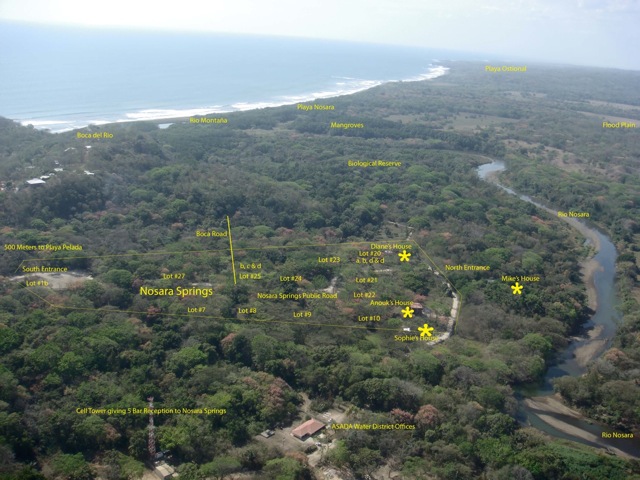

Some property owners of the Nosara Springs real estate project, located in an area near the Nosara River bed, are worried and upset about certain statements made during the meeting organized by the Nosara Leadership Forum on Thursday, March 12th.
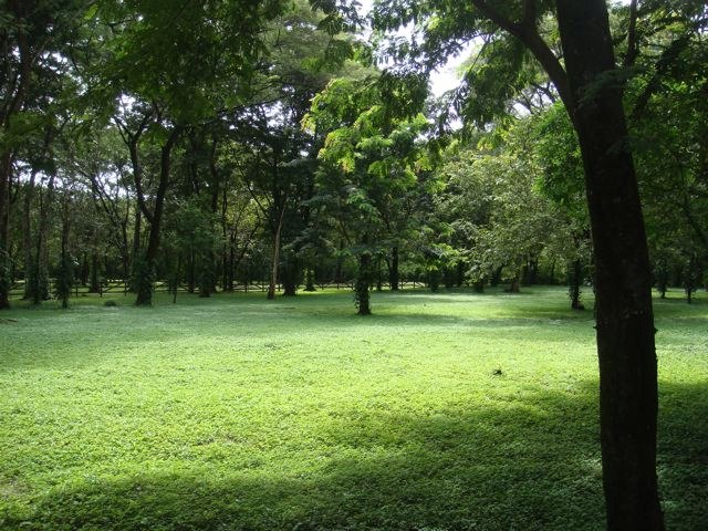
During that meeting, Marco Avila, president of the Nosara Integral Development Association (ADIN), said “Nosara Springs has always been a lagoon. It is a green area where two meters of water collect when it rains.”
Similarly, Alvaro Gonzalez, inspector from the National Irrigation and Drainage Service (SENARA- Servicio Nacional de Riego y Avenamiento), explained that the site where Nosara Springs is located, in the Peladas area, has been previously declared a flood zone by the National Emergency Commission (CNE- Comision Nacional de Emergencias), so the potential risk of flooding is not due to the construction of the dike.
Due to these statements, Michael Reif, developer and manager of the project, told The Voice of Guanacaste that these statements are false because since 2005, when he began to build the project, the water has never reached the owners’ homes.
“We are above the river bank. It is not a lagoon and has never been a lagoon. [Nosara Springs] could not possibly have two meters of rain water collecting on it,” said Reif, who also mentioned that in 2010, with the river flooding due to Hurricane Thomas, water partially reached the grounds of some properties for about two hours but never reached the houses.
In addition, Reif explained that Nosara Springs has a drainage system that allows quick and effective evacuation of rainwater.
Likewise, Anouk Studer, owner of a property in the project, said that “there has never been any lake in Nosara Springs. At least, I have lived there for seven years, including rainy seasons, and it never got two meters high water, even after three weeks of non-stop rain.”
Another concern of Reif is that, with the dredging of the river and construction of the dike, the dynamics and patterns of the river have changed, which influences the speed of the water flow and has increased sedimentation in the last section, precisely the part near Nosara Springs. Therefore, he believes that a potential flood risk exists that could affect the nearby ASADA wells and properties.
“We are still fearful that the new dike will alter the course of the river through our area. That deserves serious study,” Reif said.
In this regard, Reif provided a series of maps that show the location of the project as well as the environmental impact studies issued by SETENA and the construction permits from the Municipality of Nicoya (see archive files).

Comments