

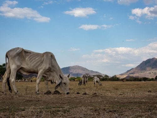
A dry plain with very skinny cows looking for grass among fields of dust. Yellow hills covered with leafless trees and dry ravines that look like stone pathways that lead to nowhere. That’s Guanacaste’s landscape during the dry season’s “summer of dusty roads,” as Malpaís sings.
This postcard picture isn’t exclusive to the province; it’s repeated in the countries that are part of the Central American Dry Corridor (Spanish acronym: CSC), a huge strip of the Pacific territory that runs through southern Mexico, Guatemala, El Salvador, Honduras, Nicaragua, Guanacaste, part of Puntarenas and the dry arch of Panama.
The term “Dry Corridor” has been used in the region for decades, but its use became more frequent beginning in the 90s and early 2000s, explained Lenin Corrales, a specialist at the Climate Action Unit of the Tropical Agricultural Research and Higher Education Center (Spanish acronym: CATIE).
“It’s hard to attribute the coinage to a specific person or entity, but it has been the United Nations’ Food and Agriculture Organization (FAO) that has given the greatest momentum to the term in recent years,” he said.
A specialist from the same department, Claudia Bouroncle, explains that there are different ways of measuring or delimiting the dry corridor.
“It’s not like defining the boundaries of a country because these criteria can vary quite a bit,” she said. “On the FAO map, it’s defined by area units that have at least four consecutive months of drought”, so the boundaries tend to be quite dynamic and can vary in time, explained Bouroncle.
That same organization has studied the impact suffered by the nearly 11 million people who live in this corridor, many dedicated to agricultural activities, especially small-scale production of basic grains.
Eighty percent of small producers now live in poverty, according to FAO figures, and their ability to sow and harvest is getting more and more critical.
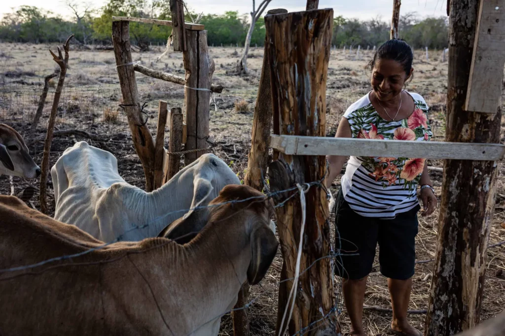
Marta Carillo herds the cattle in the last days of April, just before the May rains begin. She and her family feel that the dry season of 2019 was one of the hardest they have ever experienced.Photo: César Arroyo Castro
According to the FAO, changes in rainfall patterns in the region put corn and bean production at risk by 2050.
“[The drought] is becoming longer and more intense. Then farming families begin to have problems defining what to plant and when to plant, and this increases over time,” explained the specialist.
Although climate migration appears to be a problem in the region, there isn’t enough information to understand its magnitude, affirmed Erick Alfaro, oceanographer and researcher at the University of Costa Rica (UCR).
“In our region, many of these issues end up in reports and papers. While it’s true that the region knows that this is going to be a problem in the future, it should be reflected in research published in scientific journals, which is not happening,” he pointed out.
Where the land is rough
The problem of drought in Guanacaste is not minor. Between 2014 and 2016, when the province went through the last major drought, the government allocated ¢3,540 million (about $6.8 million USD) in subsidies for purchasing and distributing food supplies for livestock, and the future outlook is not favorable.
And although the impacts are usually measured mainly in the primary sector, in other words, agriculture and livestock, the tentacles of climate change in the dry corridor will extend to tourism, another of the province’s key activities.
Guanacaste is the area in the Central American region that will be impacted the most due to the increase in temperature, according to a report from the Economic Commission for Latin America and the Caribbean (ECLAC) called “The economics of climate change in Central America.”
“By 2050, the increase in temperature in December will be greater than in 2020, rising by 1.50 °C to 2.90 °C, with Belize being the least affected country and Costa Rica, especially Guanacaste – the most important leisure tourism area in this country – the most impacted,” it details.
And it adds that tourist sites could be affected by other problems derived from high temperatures and changes in precipitation, such as droughts, water shortages and loss of biodiversity.
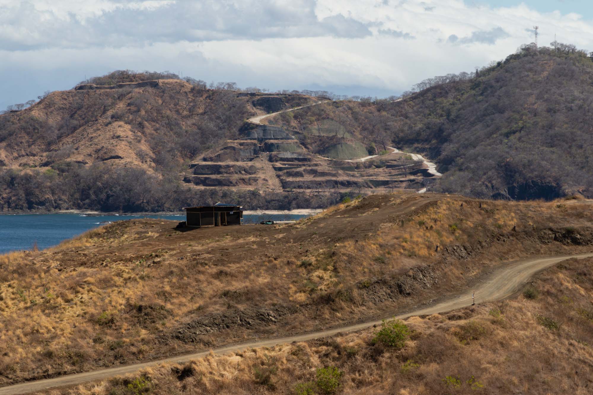
Panoramic view that allows you to see part of the Papagayo Gulf Tourism Complex (Spanish acronym: PTGP), an area between the Nacascolo districts of the canton of Liberia (in the northern part of the bay) and Sardinal de Carrillo (to the south).
Taking a beating from water
The region is experiencing and will continue to experience much longer periods of drought, but when water comes, whether due to the rainy season or the Caribbean’s wet climate events, it hits hard and will continue to cause much stronger battles.
In fact, extreme rain events, such as tropical storms, have caused the most losses in the province, according to CATIE’s Climate Action Unit specialist Lenin Corrales.
“The issue of drought in the Dry Corridor, from my perspective, has a certain reputation, but in reality in Guanacaste, only a small percentage suffers from drought and the big losses are due to other climatic processes,” he emphasized.
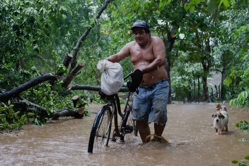
Roberto Parrales leaves his house with his three dogs in the middle of Tropical Storm Nate and heads towards the shelter from the Tucurrique neighborhood in Santa Cruz.Photo: César Arroyo Castro
Between 1988 and 2018, only 14% of losses were due to droughts, while 77% were a result of intense rains. This is reflected in a study prepared by the Ministry of National Planning and Economic Policy (Spanish acronym: MIDEPLAN) on the impact of natural phenomena for the 1988-2018 period.
The onslaught of droughts and rains are so strong in the province that universities are making an effort to better understand how these events will behave in the future in order to explain them to the communities.
UCR researchers Erick Alfaro and Hugo Hidalgo participated in the Central American Dry Corridor Comprehensive Program (Spanish acronym: PICSC), an interdisciplinary project focused on a cross-border region in crisis due to drought and poverty. Cuajiniquil and El Jobo, in La Cruz, were the two communities in which they worked.
“I believe that for a region like Guanacaste or the Central American Dry Corridor, it is vital to know what is going to happen. It’s one of the biggest uncertainties that exists at this moment, not only caused by El Niño or La Niña, but also by phenomena such as tropical cyclones and others,” Hildalgo emphasized.
But many times, not even the communities immersed in that strip of land know what they are experiencing and how it impacts them today and will harm them in the future.
“We found that sometimes they were unaware of their own climate. And we worked to make them see what products and tools they had at their disposal in terms of weather forecasts, seasonal forecasts, etcetera.,” explained Alfaro.

Comments